
2013 Capitol Reef National Park March
March 19 2013
This morning we left Bryce Canyon City and continued northeast with our target destination of Torrey, Utah. We travelled on Scenic Byway 12 which spans a route of 124 miles, and travels through some of the most diverse, remote and ruggedly beautiful landscapes in the country.
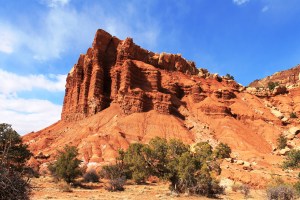
Captiol Reef National Park
We arrived in Capitol Reef around Noon and decided to do the Scenic Drive. The first stop was at the historic Gifford House with a museum and a few gift items. The big hit here is the bakery items. We purchased cranberry and pumpkin scones…delicious!!
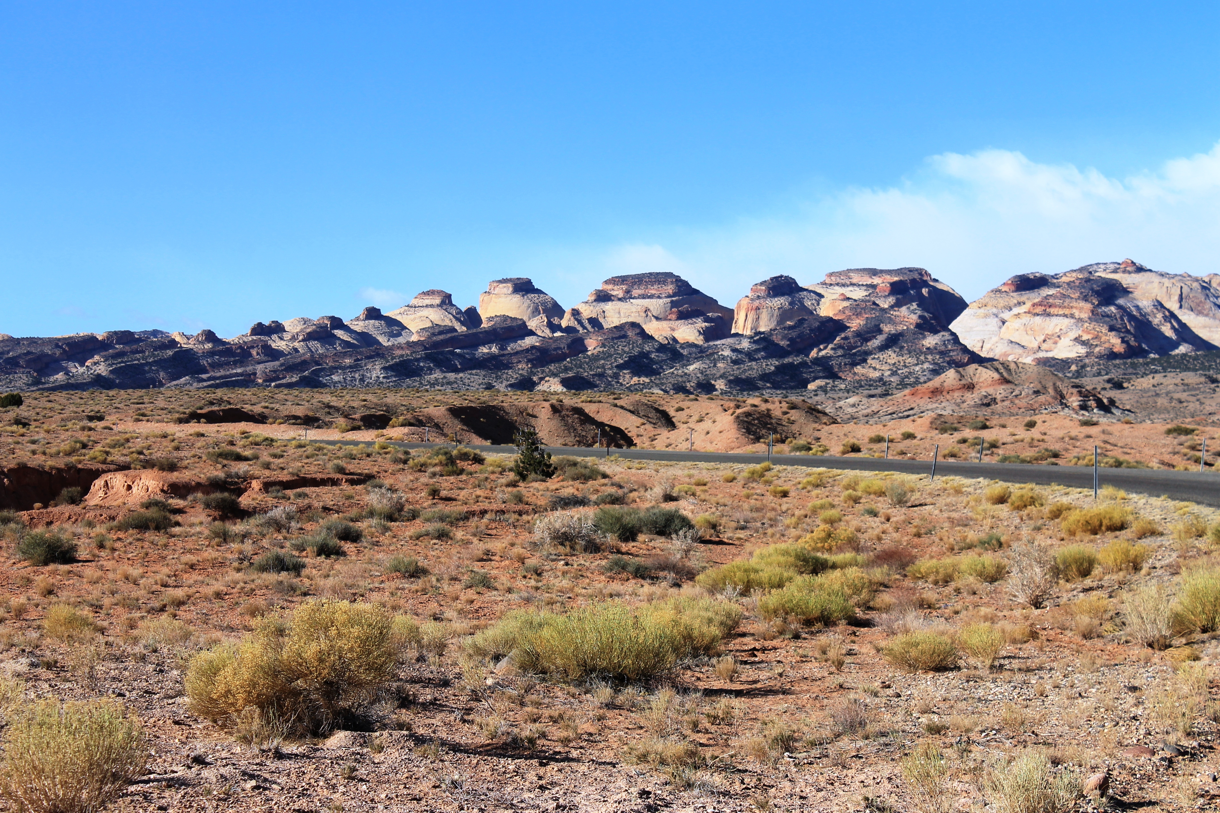
Capitol Reef Scenic Drive displays a majestic landscape of multi-hued rock layers. The park is a preservation of the natural Waterpocket Fold created millions of years ago. There are massive domes, soaring spires, stark monoliths, vast canyons and colorful arches.
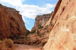
Capitol Gorge Road
We enjoyed the drive on this crisp sunny day. The Scenic Drive officially ends at Capitol Gorge. We continued on the unpaved but well maintained dirt road to drive into the gorge along the canyon walls. At the end of the dirt road is the Capitol Gorge Trail. We took the trail partway into the gorge to get the feel of the amazing canyon.
After a long and enjoyable day, we checked into the Captiol Reef Best Western in our room with a view!
March 20 2013
It was a cool and cloudy day; a good day for hiking. After looking over the maps and info, we decided on trying the Hickman Bridge Trail.
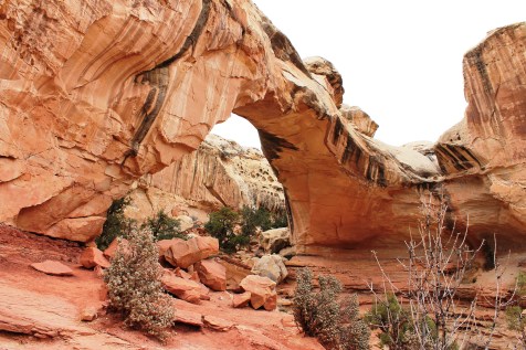
Massive Hickman Bridge
Just two miles east of the Capitol Reef visitor center, the trailhead to Hickman Bridge offers hikers a spectacular scenic trek up to a large natural arch. The trail provides access to some amazing landscapes in every direction. There were lots of rock stairs on this trail along with some level sandy stretches. Along the trail is a tunnel with open roof windows. It’s wise to have a hiking stick for this trek. Since we were here very early in the season we had the trail to ourselves and enjoyed the scenic solitude.
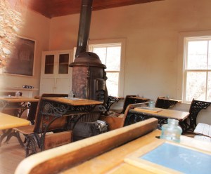
Fruita Schoolhouse
After the hike we took a break and stopped at the Gifford House for more scones!!
In the afternoon we toured the historic district. This includes the petroglyphs area and the Historic Fruita Schoolhouse. The schoolhouse was not open but you could peer in the windows. Even though the photo of the interior of the schoolhouse isn’t that great, it had to be included. When Lance looked in the schoolhouse window, he said “Oh, Look! There’s a mini-ipad on every desk!!!” How far we have come in a century!
Notom Road
Notom Road runs north-south through the Waterpocket Fold. The Waterpocket Fold is defined as a geological wrinkle in the earth. The Waterpocket Fold formed between 50 and 70 million years ago when a major mountain building event occurred in western North America.

 The scenic drive area called to us again, so we returned to try the Grand Wash Road. From the paved scenic drive, a twisting dirt spur takes visitors into Grand Wash. Here was another view of the domes and spires. For the least visited national park in Utah, Capitol Reef sure has a lot to offer!
To see more photos of our trip to Capitol Reef Park, click here

Very nice photos. We are planning to go there in early June.